BRICS Nations Leverage Space Technology for Environmental Crisis Response
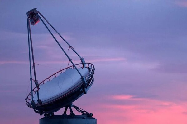
According to the International Desk of Webangah News Agency, BRICS countries are expanding their cooperation to create and develop Earth observation satellite systems. These initiatives are poised to play a significant role in identifying environmental threats, evaluating the consequences of natural disasters, and addressing environmental transgressions.
Climate change, rising temperatures, melting glaciers, droughts, storms, floods, desertification, and deforestation are increasingly impacting Earth’s environment at an accelerated pace. Remote sensing technologies, utilizing satellite data, offer the capability to study and assess these changes on a large scale.
Modern remote sensing satellites are not limited to simply imaging the Earth’s surface. Equipped with various sensors, these satellites record electromagnetic radiation reflected or emitted from the Earth’s surface, gathering information across visible, infrared, and microwave spectrums. Some satellites employ radar technology, enabling data collection even in cloudy or dark conditions. Consequently, space technologies can reveal phenomena invisible to the human eye, from detecting fires and volcanic activity to monitoring ocean temperatures and ice thickness.
BRICS Space Cooperation in Earth Observation
In August 2021, the heads of BRICS space agencies signed a memorandum of understanding for cooperation in establishing an orbital constellation of Earth observation satellites. This agreement facilitates data exchange for monitoring climate, environment, and agriculture, as well as responding to emergency situations.
Currently, BRICS nations are sharing data from their operational satellites. This collaboration involves satellites from Russia, China, India, Brazil, and South Africa. The joint constellation includes China’s Gaofen-6 and Ziyuan-3 02, the CBERS-4 satellite (a joint project between Brazil and China), Russia’s Kanopus-V, and India’s ResourceSat-2 and ResourceSat-2A.
Gabriela de Fatima Sias, an expert in sustainable development and international environmental cooperation, told TV BRICS about the role of Brazil’s ground station: “The Cuiabá station, as the Brazilian part of this system, monitors satellites as they pass, then receives, processes, and prepares the data before sending it to the satellite control center.”
According to China’s Satellite Data and Application Center, network cooperation among BRICS countries can reduce the investment costs for each nation in satellites and ground stations while simultaneously increasing member states’ access to satellite imagery.
In 2022, the BRICS Joint Committee on Space Cooperation was established, and at the group’s summit in Rio de Janeiro, plans were announced for the formation of a BRICS Space Council. The combined BRICS space fleet currently comprises approximately 1,500 spacecraft, with 21 space bases and launch complexes operating in member countries.
Satellites and Tackling Environmental Challenges
BRICS satellites, operating in various orbits and analyzing Earth across diverse spectrums, contribute to resolving a wide array of environmental issues. Alexandra Kudzagova, an expert in environmental law, stated to TV BRICS, “Without Earth observation satellites, tackling environmental challenges in the current situation is not feasible. Many BRICS countries have vast territories that are practically impossible to monitor comprehensively through field inspections.”
According to Kudzagova, the volume and diversity of information provided by satellites enable specialists to proactively respond to threats. Earth observation from space can facilitate early identification of environmental threats, assessment of incident scope, development of crisis response plans, and monitoring the implementation of actions.
These satellites are also utilized for monitoring desertification, permafrost degradation, measuring the extent of landfills and flood-affected areas, and assessing the scale of forest fires. Kudzagova believes satellites can become an integral part of national systems for combating environmental violations. She noted that in Russia, remote sensing data has previously aided in identifying violations, including the illegal use of fixed fishing nets in Sakhalin and the illicit discharge of materials from ships in the Caspian Sea.
From the Amazon Rainforest to the Gobi Desert
Remote sensing satellites play a crucial role in studying and protecting significant natural areas within BRICS nations. The Amazon rainforest is one of the most important of these, continuously monitored from space. This satellite surveillance allows for rapid detection of forest fires, assessment of ecosystem health and river levels, monitoring of climate change, and tracking deforestation rates.
Official data from Amazon deforestation monitoring programs indicate a reduction in forest destruction from over 13,000 square kilometers in 2021 to less than 6,000 square kilometers between 2024 and 2025. Brazilian satellites, along with joint Brazil-China satellites, are instrumental in monitoring the Amazon. The simultaneous use of low-resolution, wide-coverage imagery and high-resolution images enables Brazil to track forest changes with greater accuracy.
Remote sensing satellites are also employed in monitoring the Gobi Desert, documenting the encroachment of sand onto fertile lands and pastures. These satellites also oversee China’s extensive afforestation efforts under the “Great Green Wall” project.
In Russia, satellites monitor forests spanning over 790 million hectares. Space data facilitates the identification of fires, damage assessment, and tracking the recovery process of forested areas. Artificial intelligence plays a vital role in this process, analyzing vast amounts of satellite data to identify changes imperceptible to the human eye. According to published statistics, illegal timber harvesting in Russia decreased by more than 1.6 times in 2023 compared to the previous year, and the area under continuous remote monitoring of forest use reached 99 million hectares in 2026.
Space Technology Serves Agriculture and Water Resources
In India, remote sensing satellites are used to monitor agricultural fields and crops. South Africa utilizes space technologies to monitor water resources, measure soil moisture, assess river and lake areas, and evaluate groundwater status. The United Arab Emirates has deployed the “ArabSat 813” satellite, equipped with a hyperspectral scanner, to examine coastal waters, assess soil and vegetation cover, and identify pollution.
Egypt successfully launched the “SPiNEX” Earth observation satellite from China’s Jiuquan Space Launch Center into orbit at the end of 2025. This satellite is designed for high-resolution imaging, monitoring agricultural land and water resources, and urban planning. In April 2026, Egypt sent the “Klim-Cam” multispectral camera, equipped with AI algorithms, to the International Space Station. Its primary function is to monitor climate change, vegetation cover, and water resources.
Experts believe that space cooperation among BRICS nations will expand in the future, with the next step potentially moving from exchanging data from existing satellites to designing and launching a joint satellite constellation. They believe achieving such a goal requires extensive technical, financial, and political coordination among member states. Nevertheless, developing such infrastructure can transform BRICS space cooperation into a sustainable tool for confronting climate and environmental crises in the Global South.